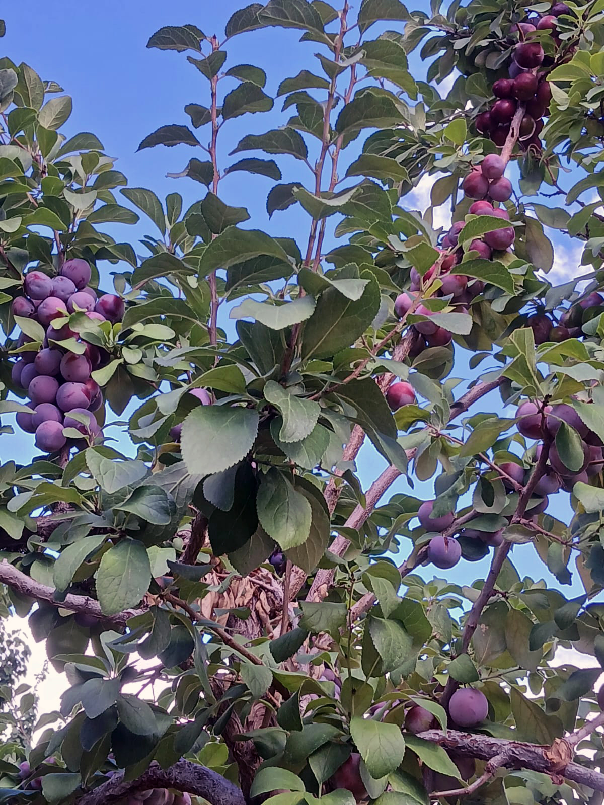
The Kham-skyur plum in Skurbuchan
I am not a botanist or horticultural expert. My interest in the Kham-skyur began simply with its visual allure. Over the past year, I found myself repeatedly drawn to photographs and fleeting glimpses of this wild plum, until curiosity about the tree slowly turned into wonder about the landscape, language, and history surrounding it, especially the remarkable toponymy preserved in the name of Skurbuchan.
In the sheltered contours of Ladakh’s Sham valley, language and landscape are not merely neighbours; they are part of the same woven fabric. Wander into the village of Skurbuchan (also rendered Skyurbuchan and Skurbu chan), and you enter a place whose very name preserves the memory of a fruit, turning the landscape itself into a kind of living botanical map.
At the heart of this landscape is the Kham-skyur (also rendered Khamskyur or locally pronounced Khamskur), which is locally regarded as Ladakh’s only known wild plum. In Tibetan, as preserved in Ladakhi usage, ‘skyur’ means ‘sour’, while ‘kham’ or ‘khambu’ appears in older Himalayan/Tibetan orchard vocabulary to describestone fruits or fleshy pit-bearing fruits (drupes). Examples include Ngari Khambu, the Ladakhi sweet apricot. Together, the name evokes the fruit’s sharp tartness before ripening. Under the intense sunlight, dry air, and dramatic day-night temperature shifts of high altitude Ladakh, the fruit gradually develops a richer sweetness by harvest season. Older residents still remember the plum as sharply sour in earlier decades, when children often ate the fruit before it had fully ripened. Some villagers today, however, observe that the ripe fruits have become noticeably sweeter than in the past. Yet, the older memory of its sour bite survives in the name itself.
The village name Skurbuchan carries a similar botanical echo. Derived from Tibetan roots, ‘skyur-bu’ (‘sour fruit’ or ‘sour thing’) and ‘-chan’ (‘possessing’ or ‘having’), it may be understood as ‘the place of sour fruits’ or ‘the place that has the sour fruit’. Few examples of Himalayan toponymy preserve such a direct relationship between ecology, language, and settlement identity.
Botanically, the Kham-skyur is unusual in Ladakh’s harsh mountain environment. The tree thrives primarily in the lower, relatively sheltered elevations of the Sham region and struggles in the colder upper plateau zones. Its highly localised presence has led some observers to describe it as a kind of ‘genetic island’ in Ladakh’s flora. Recent botanical documentation has identified specimens in Skurbuchan as greengage plum (Prunus domestica subsp. italica), a notable addition to the recorded flora of Ladakh, even as local tradition continues to emphasise the fruit’s near-wild character.
Its origins remain uncertain. The plum may reflect older patterns of horticultural exchange moving through Himalayan and Central Asian trade corridors over centuries. In this sense, the Kham-skyur stands not merely as a fruit tree, but as a quiet survivor of the wider trans-Himalayan world that once linked Ladakh with Baltistan, Tibet, Kashmir, and Central Asia.
Whatever its route into Ladakh, the tree has adapted well to the microclimate of the Sham valley and become woven into local memory, vocabulary, and identity. Even today, during harvest season, heavily laden branches and clusters of ripening fruit remain part of the valley’s quiet horticultural rhythm. By late summer, the boughs hang heavy with tightly clustered purple fruit against the stark mountain light, and older villagers still distinguish between individual trees by taste, colour, and the sharpness of the fruit before ripening.
More unusual still is the fact that in Skurbuchan itself, the Kham-skyur trees are said to only survive largely in two small plots. Local accounts speak of barely 30 mature trees in total, with offshoots growing vigorously around them, often bearing broader leaves than the older parent trees. Elders in the village recall that in earlier times, when fruit trees were relatively scarce in the valley, children would pluck the plums before they had fully ripened, rarely allowing the fruit to mature completely on the branches. Even fallen fruits rarely went to waste; older generations traditionally gathered them and ground them into a tart paste known as ‘chattin’, mixed with fresh mountain herbs and eaten with thick traditional breads.
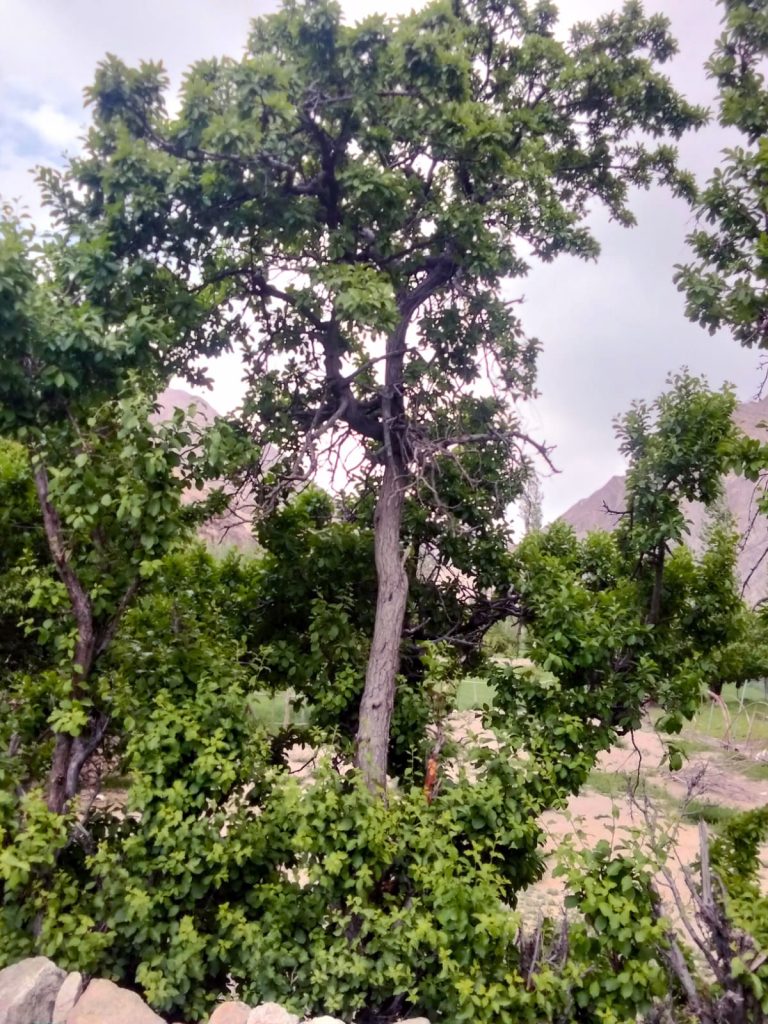
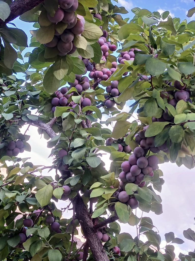
The Kham-skyur trees in Skurbuchan
This extreme localisation gives the Kham-skyur both rarity and vulnerability. The small surviving population, concentrated largely around Skurbuchan and neighbouring areas, remains susceptible to climate stress, disease, and the gradual loss of aging trees. Oral accounts speak of particularly old specimens that continue to bear fruit, reinforcing the sense that these trees are not merely crops, but living cultural inheritances.
In the early-20th Century, German missionary-scholar, A. H. Francke recorded the rarity of the tree in striking terms. Referring to the Kham skyur, he wrote: “It is the only plum existing in Ladakh and is a very rare tree at the present day. A few specimens exist at Skyarbucan, but the fruit is so sour that it is not eaten at the present day.” His observation captures an earlier moment in the fruit’s cultural history, when the plum was valued more as a botanical curiosity than everyday food.
That rarity may also hold modest economic potential in the future. Across the Himalayan world, unusual mountain fruits have increasingly attracted attention because of their highly localised habitats, distinctive appearance, and association with extreme high altitude environments. The much-publicised ‘black diamond’ apples of Nyingchi (pronounced Nyingthri) in Tibet are perhaps the best-known example, associated with premium niche fruit markets because of their striking appearance and high altitude terroir. The Kham-skyur possesses a similarly distinctive story: a sour-to-sweet transformation shaped by altitude, a concentrated habitat within the Sham Valley, and a linguistic history embedded into the very name of a village. While still little known outside the region, the fruit’s rarity and unusual character could eventually lend themselves to small-scale heritage branding, carefully linked to conservation and local stewardship rather than rapid commercialisation.
Skurbuchan is already gaining wider recognition through its apricot blossom festivals, which celebrate the valley’s horticultural landscape each spring. The Kham-skyur could naturally extend this emerging cultural tourism identity, adding another layer to the village’s botanical heritage. Seasonal orchard walks, plum harvest experiences, local storytelling, and traditional food products could help position the Sham valley not merely as a scenic destination, but as a living cultural landscape shaped by centuries of cultivation and ecological adaptation.
Carefully developed, the fruit could support a small but valuable heritage economy. Dried plums, preserves, juices, or artisanal products could provide supplemental income while encouraging conservation of old orchards and traditional practices.
Yet any expansion must be cautious. Preserving genetic distinctiveness and ecological resilience matters more than rapid commercialisation. Propagation efforts, local stewardship, and careful documentation will be essential if the Kham-skyur is to survive beyond a handful of aging trees. In Skurbuchan, the Kham-skyur is more than a fruit. It is edible heritage, a reminder that landscapes are shaped not only by mountains and rivers, but also by the species people nurture, the tastes they remember, and the names they leave behind. To protect these trees is to preserve not simply a crop, but a small living archive of Ladakh’s cultural and ecological memory.
By Phuntsog Tsering
Photographs by Dr Tsering Phuntsog
Phuntsog Tsering is an entrepreneur from Leh and manages Migsal WoodWorks.
Dr. Tsering Phuntsog is a retired veterinarian from Skurbuchan with a keen interest in Ladakhi folklore, history, and mythology.